656 Duncan Dr
Vacaville, CA 95687
- 4Beds
- 3Baths
- 1,942ft²Living Area
- 6,969ft²Lot Size
- 1Pool
- 2Car
- 1978Year Built
- -DOM
- 6Permits
Property Valuations
Latest estimates for 656 Duncan Dr based on TopHap automated valuation model (AVM).
TopHap Estimate
$629,000
$323/ft²
+$257K above Sold Price
Updated 7 months ago
Last Sold Price
$372,000
$192/ft²
9 years ago
656 Duncan Dr is valued at $629,000 by TopHap AVM 7 months ago.
656 Duncan Dr was last sold in 2016 for $372,000.
Permits
656 Duncan Dr has 6 permit records.
Current Ownership
Information about the current owner(s).
Taxes Billed
Taxes billed in 2023$5,239.64From latest Total Assessed Value1.17%Total Assessed Value$448,494=Land+
Assessed Value$102,402Additions
Assessed Value$346,092
In 2023, taxes billed for 656 Duncan Dr were $5,239.64, which is 1.17% from latest Total Assessed Value of $448,494.
Property History
656 Duncan Dr has undefined property events records (listings, deeds, permits, tax, foreclosure, loan).
Environment
Environmental factors around 656 Duncan Dr
Hazard Risks
Earthquake377Nat'l Avg100Particulates89Ozone87Carb Mono83Air Pollution83Lead45Tornado3Wind2Hail1Weather1Hurricane0
11 hazards (Carbon Monoxide, Earthquake Risk, Hail Index, Tornado Index, Air Pollution Index, Ozone Index, Wind Index, Weather Risk, Lead Index, Particulate Matter, National Average) are above the national average around 656 Duncan Dr.
Walkability Index
13 /20
Most Walkable
20-18
Very Walkable
17-15
Somewhat Walkable
14-10
Car Dependent
9-0
656 Duncan Dr has a walkability score of 13 out of 20, which means that it is in a somewhat walkable area.
Noise Level
45 dB
Quiet Suburban Residential 0-49
Suburban Residential 50-54
Urban Residential 55-59
Noisy Urban Residential 60-64
Very Noisy Urban Residential 65+
Noise at 656 Duncan Dr is around 45dBs, which is comparable to a Quiet Suburban Residential area.
Temperature
Seasonal temperature sampled over multiple years
Winter
Average
Low
38°F
High
57°F
Summer
Average
Low
56°F
High
89°F
In the winter at 656 Duncan Dr, temperatures range from 38.47°F to 56.9°F with an average of 47.69°F. In the summer, the temperature ranges from 55.71°F to 89.04°F with and average of 72.38°F.
School Information
Public/private schools serving 656 Duncan Dr
Public Schools
Nearby public schools serving 656 Duncan Dr have ratings undefined, undefined, and undefined.
Neighborhood
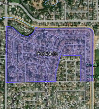
This property is located in Parkside, Vacaville, CA 95687.
Seasonal Housing units 95687
13%of housing is for seasonal rent.
Daytime Population for 95687
-11%of people during work hours.
Boundary map of Parkside.
Crime Index for 95687
71
The crime index in 95687 is 71, which is 0.7 times lower than national average.
Market Trends
Historical market data near 656 Duncan Dr over selected time period.
Nearby Properties on Duncan Dr
- 656 Duncan Dr, Vacaville, CA 95687 (Parkside) is a 1,942 square foot, 4 bedroom, 3.25 bathroom, 0.16 acre property. It was built in 1978 and has an estimate of $584,012 with a price per ft² of $301.
- 638 Duncan Dr, Vacaville, CA 95687 (Parkside) is a 1,626 square foot, 3 bedroom, 3 bathroom, 0.16 acre property. It was built in 1978 and has an estimate of $583,590 with a price per ft² of $359.
- 662 Duncan Dr, Vacaville, CA 95687 (Parkside) is a 2,015 square foot, 4 bedroom, 3.25 bathroom, 0.15 acre property. It was built in 1978 and has an estimate of $599,908 with a price per ft² of $298.
- 668 Duncan Dr, Vacaville, CA 95687 (Parkside) is a 1,626 square foot, 3 bedroom, 3 bathroom, 0.14 acre property. It was built in 1978 and has an estimate of $544,189 with a price per ft² of $335.
- 663 Duncan Dr, Vacaville, CA 95687 (Parkside) is a 1,626 square foot, 3 bedroom, 3 bathroom, 0.18 acre property. It was built in 1978 and has an estimate of $568,653 with a price per ft² of $350.
- 657 Duncan Dr, Vacaville, CA 95687 (Parkside) is a 1,895 square foot, 4 bedroom, 3 bathroom, 0.17 acre property. It was built in 1978 and has an estimate of $595,398 with a price per ft² of $314.
- 650 Duncan Dr, Vacaville, CA 95687 (Parkside) is a 2,015 square foot, 4 bedroom, 3 bathroom, 0.18 acre property. It was built in 1978 and has an estimate of $615,220 with a price per ft² of $305.
- 644 Duncan Dr, Vacaville, CA 95687 (Parkside) is a 1,895 square foot, 4 bedroom, 2.5 bathroom, 0.15 acre property. It was built in 1978 and has an estimate of $589,163 with a price per ft² of $311.
- 633 Duncan Dr, Vacaville, CA 95687 (Parkside) is a 1,526 square foot, 3 bedroom, 2 bathroom, 0.15 acre property. It was built in 1980 and has an estimate of $549,897 with a price per ft² of $360.
- 627 Duncan Dr, Vacaville, CA 95687 (Parkside) is a 1,870 square foot, 4 bedroom, 2 bathroom, 0.15 acre property. It was built in 1980 and has an estimate of $539,438 with a price per ft² of $288.
- 686 Duncan Dr, Vacaville, CA 95687 (Parkside) is a 2,015 square foot, 4 bedroom, 3.25 bathroom, 0.14 acre property. It was built in 1978 and has an estimate of $600,312 with a price per ft² of $298.
- 692 Duncan Dr, Vacaville, CA 95687 (Parkside) is a 1,626 square foot, 3 bedroom, 3.25 bathroom, 0.17 acre property. It was built in 1978 and has an estimate of $572,457 with a price per ft² of $352.
- 680 Duncan Dr, Vacaville, CA 95687 (Parkside) is a 1,895 square foot, 4 bedroom, 3 bathroom, 0.15 acre property. It was built in 1978 and has an estimate of $589,295 with a price per ft² of $311.
- 698 Duncan Dr, Vacaville, CA 95687 (Parkside) is a 1,368 square foot, 3 bedroom, 2 bathroom, 0.18 acre property. It was built in 1978 and has an estimate of $527,090 with a price per ft² of $385.
- 615 Duncan Dr, Vacaville, CA 95687 (Parkside) is a 1,526 square foot, 3 bedroom, 2 bathroom, 0.13 acre property. It was built in 1980 and has an estimate of $535,065 with a price per ft² of $351.
- 674 Duncan Dr, Vacaville, CA 95687 (Parkside) is a 1,803 square foot, 4 bedroom, 3 bathroom, 0.14 acre property. It was built in 1978 and has an estimate of $564,117 with a price per ft² of $313.
- 681 Duncan Dr, Vacaville, CA 95687 (Parkside) is a 1,551 square foot, 4 bedroom, 2 bathroom, 0.19 acre property. It was built in 1978 and has an estimate of $550,481 with a price per ft² of $355.
- 687 Duncan Dr, Vacaville, CA 95687 (Parkside) is a 1,551 square foot, 4 bedroom, 2 bathroom, 0.16 acre property. It was built in 1978 and has an estimate of $536,436 with a price per ft² of $346.
- 621 Duncan Dr, Vacaville, CA 95687 (Parkside) is a 1,526 square foot, 3 bedroom, 2 bathroom, 0.14 acre property. It was built in 1980 and has an estimate of $519,016 with a price per ft² of $340.