455 Ipswich Rd
Boxford, MA 01921
- 4Beds
- 2Baths
- 1,890ft²Living Area
- 2acLot Size
- -Pool
- -Car
- 1923Year Built
- -DOM
- -Permit
Property Valuations
Latest estimates for 455 Ipswich Rd based on TopHap automated valuation model (AVM).
TopHap Estimate
$723,500
$382/ft²
+$344K above Sold Price
Updated 7 months ago
Last Sold Price
$380,000
$201/ft²
24 years ago
455 Ipswich Rd is valued at $723,500 by TopHap AVM 7 months ago.
455 Ipswich Rd was last sold in 2001 for $380,000.
Current Ownership
Information about the current owner(s).
Taxes Billed
Taxes billed in 2024$7,709.00From latest Total Assessed Value1.31%Total Assessed Value$590,700=Land+
Assessed Value$399,900Additions
Assessed Value$190,800
In 2024, taxes billed for 455 Ipswich Rd were $7,709, which is 1.31% from latest Total Assessed Value of $590,700.
Property History
455 Ipswich Rd has undefined property events records (listings, deeds, permits, tax, foreclosure, loan).
Environment
Environmental factors around 455 Ipswich Rd
Hazard Risks
Hurricane118Lead103Nat'l Avg100Ozone97Air Pollution97Weather93Earthquake89Carb Mono86Particulates86Wind71Hail61Tornado61
12 hazards (Carbon Monoxide, Earthquake Risk, Hail Index, Tornado Index, Hurricane Index, Air Pollution Index, Ozone Index, Wind Index, Weather Risk, Lead Index, Particulate Matter, National Average) are above the national average around 455 Ipswich Rd.
Walkability Index
6 /20
Most Walkable
20-18
Very Walkable
17-15
Somewhat Walkable
14-10
Car Dependent
9-0
455 Ipswich Rd has a walkability score of 6 out of 20, which means that it is in a car dependent area.
Temperature
Seasonal temperature sampled over multiple years
Winter
Average
Low
19°F
High
37°F
Summer
Average
Low
58°F
High
80°F
In the winter at 455 Ipswich Rd, temperatures range from 18.82°F to 36.73°F with an average of 27.78°F. In the summer, the temperature ranges from 58.29°F to 80.12°F with and average of 69.21°F.
School Information
Public/private schools serving 455 Ipswich Rd
Public Schools
Nearby public schools serving 455 Ipswich Rd have ratings undefined, undefined, undefined, and undefined.
Neighborhood
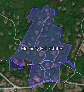
This property is located in Memory Hill Estates, Boxford, MA 01921.
Seasonal Housing units 01921
12%of housing is for seasonal rent.
Daytime Population for 01921
-7%of people during work hours.
Boundary map of Memory Hill Estates.
Crime Index for 01921
10
The crime index in 01921 is 10, which is 0.1 times lower than national average.
Market Trends
Historical market data near 455 Ipswich Rd over selected time period.
Nearby Properties on Ipswich Rd
- 532 Ipswich Rd, Boxford, MA 01921 is a 2,886 square foot, 4 bedroom, 4.25 bathroom, 2.22 acre property. It was built in 1983 and has an estimate of $991,242 with a price per ft² of $343.
- 526 Ipswich Rd, Boxford, MA 01921 is a 1,428 square foot, 2 bedroom, 2.25 bathroom, 2 acre property. It was built in 1976 and has an estimate of $797,505 with a price per ft² of $558.
- 310 Ipswich Rd, Boxford, MA 01921 is a 1,828 square foot, 4 bedroom, 3.25 bathroom, 1.15 acre property. It was built in 1957 and has an estimate of $641,667 with a price per ft² of $351.
- 306 Ipswich Rd, Boxford, MA 01921 is a 1,960 square foot, 3 bedroom, 3.25 bathroom, 1.02 acre property. It was built in 1956 and has an estimate of $687,960 with a price per ft² of $351.
- 218 Ipswich Rd, Boxford, MA 01921 is a 1,312 square foot, 3 bedroom, 2.25 bathroom, 2.05 acre property. It was built in 1965 and has an estimate of $613,486 with a price per ft² of $468.
- 259 Ipswich Rd, Boxford, MA 01921 is a 1,502 square foot, 3 bedroom, 2 bathroom, 2.11 acre property. It was built in 1952 and has an estimate of $760,717 with a price per ft² of $506.
- 144 Ipswich Rd, Boxford, MA 01921 is a 2,084 square foot, 3 bedroom, 2.25 bathroom, 1.63 acre property. It was built in 1956 and has an estimate of $544,720 with a price per ft² of $261.
- 554 Ipswich Rd, Boxford, MA 01921 is a 3,067 square foot, 4 bedroom, 3.25 bathroom, 2.53 acre property. It was built in 1960 and has an estimate of $1,183,158 with a price per ft² of $386.
- 473 Ipswich Rd, Boxford, MA 01921 (Memory Hill Estates) is a 3,446 square foot, 4 bedroom, 3.25 bathroom, 2.03 acre property. It was built in 1993 and has an estimate of $1,019,106 with a price per ft² of $296.
- 377 Ipswich Rd, Boxford, MA 01921 is a 2,766 square foot, 4 bedroom, 3.25 bathroom, 2.04 acre property. It was built in 1976 and has an estimate of $1,050,340 with a price per ft² of $380.
- 494 Ipswich Rd, Boxford, MA 01921 is a 1,216 square foot, 3 bedroom, 1 bathroom, 50.4 acre property. It was built in 1954 and has an estimate of $552,231 with a price per ft² of $454.
- 106 Ipswich Rd, Boxford, MA 01921 is a 3,363 square foot, 4 bedroom, 4.25 bathroom, 5.37 acre property. It was built in 1919 and has an estimate of $1,130,697 with a price per ft² of $336.
- 22 Ipswich Rd, Boxford, MA 01921 is a 3,308 square foot, 5 bedroom, 6.5 bathroom, 2.01 acre property. It was built in 1969 and has an estimate of $1,069,821 with a price per ft² of $323.
- 185 Ipswich Rd, Boxford, MA 01921 is a 3,507 square foot, 3 bedroom, 4.25 bathroom, 5.35 acre property. It was built in 1953 and has an estimate of $1,111,863 with a price per ft² of $317.
- 520 Ipswich Rd, Boxford, MA 01921 is a 4,208 square foot, 5 bedroom, 4.25 bathroom, 2.04 acre property. It was built in 2000 and has an estimate of $1,226,223 with a price per ft² of $291.
- 496 Ipswich Rd, Boxford, MA 01921 is a 2,412 square foot, 4 bedroom, 3.25 bathroom, 2.1 acre property. It was built in 1939 and has an estimate of $897,664 with a price per ft² of $372.
- 474 Ipswich Rd, Boxford, MA 01921 is a 4,034 square foot, 4 bedroom, 3.25 bathroom, 3.66 acre property. It was built in 1731 and has an estimate of $1,013,921 with a price per ft² of $251.
- 455 Ipswich Rd, Boxford, MA 01921 (Memory Hill Estates) is a 1,890 square foot, 4 bedroom, 2.25 bathroom, 2 acre property. It was built in 1923 and has an estimate of $617,509 with a price per ft² of $327.
- 409 Ipswich Rd, Boxford, MA 01921 is a 2,743 square foot, 4 bedroom, 3.25 bathroom, 1.79 acre property. It was built in 1949 and has an estimate of $773,752 with a price per ft² of $282.
- 346 Ipswich Rd, Boxford, MA 01921 is a 2,907 square foot, 3 bedroom, 3 bathroom, 1.07 acre property. It was built in 1954 and has an estimate of $784,410 with a price per ft² of $270.
- 252 Ipswich Rd, Boxford, MA 01921 is a 2,844 square foot, 4 bedroom, 3.25 bathroom, 2.09 acre property. It was built in 1995 and has an estimate of $988,709 with a price per ft² of $348.
- 282 Ipswich Rd, Boxford, MA 01921 is a 3,836 square foot, 4 bedroom, 3.25 bathroom, 2.02 acre property. It was built in 1840 and has an estimate of $881,928 with a price per ft² of $230.
- 294 Ipswich Rd, Boxford, MA 01921 is a 2,487 square foot, 4 bedroom, 3 bathroom, 2.19 acre property. It was built in 1996 and has an estimate of $899,940 with a price per ft² of $362.
- 213 Ipswich Rd, Boxford, MA 01921 is a 5.59 acre property.
- 154 Ipswich Rd, Boxford, MA 01921 is a 4,047 square foot, 3 bedroom, 3.25 bathroom, 2.29 acre property. It was built in 1954 and has an estimate of $1,087,684 with a price per ft² of $269.
- View more properties on Ipswich Rd