37961 Rockspray St
Newark, CA 94560
- 4Beds
- 2Baths
- 1,391ft²Living Area
- 7,600ft²Lot Size
- -Pool
- -Car
- 1969Year Built
- -DOM
- -Permit
Property Valuations
Latest estimates for 37961 Rockspray St based on TopHap automated valuation model (AVM).
TopHap Estimate
$1,400,250
$1,006/ft²
+$1M above Sold Price
Updated 6 months ago
Last Sold Price
$395,000
$284/ft²
14 years ago
37961 Rockspray St is valued at $1,400,250 by TopHap AVM 6 months ago.
37961 Rockspray St was last sold in 2010 for $395,000.
Current Ownership
Information about the current owner(s).
Taxes Billed
Taxes billed in 2023$6,297.86From latest Total Assessed Value1.29%Total Assessed Value$486,390=Land+
Assessed Value$145,917Additions
Assessed Value$340,473
In 2023, taxes billed for 37961 Rockspray St were $6,297.86, which is 1.29% from latest Total Assessed Value of $486,390.
Property History
37961 Rockspray St has undefined property events records (listings, deeds, permits, tax, foreclosure, loan).
Environment
Environmental factors around 37961 Rockspray St
Hazard Risks
Earthquake441Particulates106Carb Mono105Nat'l Avg100Air Pollution87Ozone85Lead44Tornado10Weather3Wind3Hail0Hurricane0
10 hazards (Carbon Monoxide, Earthquake Risk, Tornado Index, Air Pollution Index, Ozone Index, Wind Index, Weather Risk, Lead Index, Particulate Matter, National Average) are above the national average around 37961 Rockspray St.
Walkability Index
16 /20
Most Walkable
20-18
Very Walkable
17-15
Somewhat Walkable
14-10
Car Dependent
9-0
37961 Rockspray St has a walkability score of 16 out of 20, which means that it is in a very walkable area.
Temperature
Seasonal temperature sampled over multiple years
Winter
Average
Low
42°F
High
59°F
Summer
Average
Low
55°F
High
77°F
In the winter at 37961 Rockspray St, temperatures range from 41.71°F to 58.78°F with an average of 50.25°F. In the summer, the temperature ranges from 54.98°F to 76.68°F with and average of 65.83°F.
School Information
Public/private schools serving 37961 Rockspray St
Public Schools
Nearby public schools serving 37961 Rockspray St have ratings undefined, undefined, undefined, and undefined.
Neighborhood
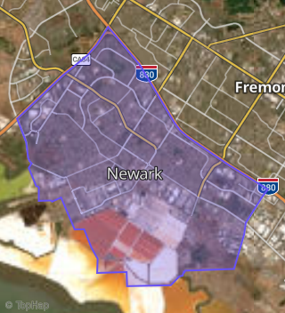
This property is located in Newark, Newark, CA 94560.
Seasonal Housing units 94560
18%of housing is for seasonal rent.
Daytime Population for 94560
+7%of people during work hours.
Boundary map of Newark.
Crime Index for 94560
41
The crime index in 94560 is 41, which is 0.4 times lower than national average.
Market Trends
Historical market data near 37961 Rockspray St over selected time period.
Nearby Properties on Rockspray St
- 37738 Rockspray St, Newark, CA 94560 (Newark) is a 1,802 square foot, 3 bedroom, 3.25 bathroom, 0.16 acre property. It was built in 1973 and has an estimate of $1,132,874 with a price per ft² of $629.
- 37772 Rockspray St, Newark, CA 94560 (Newark) is a 1,152 square foot, 3 bedroom, 2 bathroom, 0.16 acre property. It was built in 1973 and has an estimate of $932,258 with a price per ft² of $809.
- 37863 Rockspray St, Newark, CA 94560 (Newark) is a 1,635 square foot, 4 bedroom, 2 bathroom, 0.15 acre property. It was built in 1972 and has an estimate of $956,523 with a price per ft² of $585.
- 37864 Rockspray St, Newark, CA 94560 (Newark) is a 1,541 square foot, 3 bedroom, 2 bathroom, 0.17 acre property. It was built in 1969 and has an estimate of $1,116,838 with a price per ft² of $725.
- 37945 Rockspray St, Newark, CA 94560 (Newark) is a 1,391 square foot, 4 bedroom, 2 bathroom, 0.16 acre property. It was built in 1969 and has an estimate of $983,083 with a price per ft² of $707.
- 37961 Rockspray St, Newark, CA 94560 (Newark) is a 1,391 square foot, 4 bedroom, 2 bathroom, 0.17 acre property. It was built in 1969 and has an estimate of $1,023,441 with a price per ft² of $736.
- 37901 Rockspray St, Newark, CA 94560 (Newark) is a 1,958 square foot, 4 bedroom, 2 bathroom, 0.16 acre property. It was built in 1969 and has an estimate of $1,207,828 with a price per ft² of $617.
- 37794 Rockspray St, Newark, CA 94560 (Newark) is a 1,880 square foot, 4 bedroom, 2 bathroom, 0.17 acre property. It was built in 1969 and has an estimate of $1,083,469 with a price per ft² of $576.
- 37773 Rockspray St, Newark, CA 94560 (Newark) is a 1,295 square foot, 3 bedroom, 2 bathroom, 0.16 acre property. It was built in 1973 and has an estimate of $1,010,493 with a price per ft² of $780.
- 37923 Rockspray St, Newark, CA 94560 (Newark) is a 1,166 square foot, 3 bedroom, 2 bathroom, 0.16 acre property. It was built in 1969 and has an estimate of $895,991 with a price per ft² of $768.
- 37964 Rockspray St, Newark, CA 94560 (Newark) is a 1,166 square foot, 3 bedroom, 2 bathroom, 0.17 acre property. It was built in 1969 and has an estimate of $951,536 with a price per ft² of $816.
- 37946 Rockspray St, Newark, CA 94560 (Newark) is a 1,391 square foot, 4 bedroom, 2 bathroom, 0.16 acre property. It was built in 1975 and has an estimate of $954,924 with a price per ft² of $687.
- 37928 Rockspray St, Newark, CA 94560 (Newark) is a 1,166 square foot, 3 bedroom, 2 bathroom, 0.17 acre property. It was built in 1970 and has an estimate of $986,628 with a price per ft² of $846.
- 37889 Rockspray St, Newark, CA 94560 (Newark) is a 1,956 square foot, 4 bedroom, 3.25 bathroom, 0.16 acre property. It was built in 1969 and has an estimate of $1,144,068 with a price per ft² of $585.
- 37768 Rockspray St, Newark, CA 94560 (Newark) is a 1,512 square foot, 4 bedroom, 2 bathroom, 0.15 acre property. It was built in 1974 and has an estimate of $973,646 with a price per ft² of $644.
- 37782 Rockspray St, Newark, CA 94560 (Newark) is a 1,432 square foot, 4 bedroom, 2.25 bathroom, 0.17 acre property. It was built in 1969 and has an estimate of $1,027,667 with a price per ft² of $718.
- 37761 Rockspray St, Newark, CA 94560 (Newark) is a 1,593 square foot, 3 bedroom, 2.5 bathroom, 0.16 acre property. It was built in 1974 and has an estimate of $1,091,394 with a price per ft² of $685.
- 37697 Rockspray St, Newark, CA 94560 (Newark) is a 1,512 square foot, 4 bedroom, 2 bathroom, 0.19 acre property. It was built in 1974 and has an estimate of $990,656 with a price per ft² of $655.
- 37739 Rockspray St, Newark, CA 94560 (Newark) is a 1,512 square foot, 4 bedroom, 2 bathroom, 0.16 acre property. It was built in 1973 and has an estimate of $1,068,846 with a price per ft² of $707.
- 37783 Rockspray St, Newark, CA 94560 (Newark) is a 1,295 square foot, 3 bedroom, 2 bathroom, 0.16 acre property. It was built in 1972 and has an estimate of $1,000,221 with a price per ft² of $772.
- 37797 Rockspray St, Newark, CA 94560 (Newark) is a 1,295 square foot, 3 bedroom, 2 bathroom, 0.16 acre property. It was built in 1974 and has an estimate of $997,231 with a price per ft² of $770.
- 37819 Rockspray St, Newark, CA 94560 (Newark) is a 1,295 square foot, 3 bedroom, 2 bathroom, 0.16 acre property. It was built in 1974 and has an estimate of $1,008,049 with a price per ft² of $778.
- 37841 Rockspray St, Newark, CA 94560 (Newark) is a 1,152 square foot, 3 bedroom, 2 bathroom, 0.16 acre property. It was built in 1972 and has an estimate of $898,107 with a price per ft² of $780.
- 37696 Rockspray St, Newark, CA 94560 (Newark) is a 1,512 square foot, 4 bedroom, 2 bathroom, 0.18 acre property. It was built in 1973 and has an estimate of $1,028,548 with a price per ft² of $680.
- 37884 Rockspray St, Newark, CA 94560 (Newark) is a 1,391 square foot, 4 bedroom, 2 bathroom, 0.18 acre property. It was built in 1970 and has an estimate of $906,657 with a price per ft² of $652.
- View more properties on Rockspray St