285 Chestnut St
Woodland, CA 95695
- 4Beds
- 2Baths
- 1,990ft²Living Area
- 6,324ft²Lot Size
- -Pool
- 2Car
- 1967Year Built
- -DOM
- -Permit
Property Valuations
Latest estimates for 285 Chestnut St based on TopHap automated valuation model (AVM).
TopHap Estimate
$600,500
$301/ft²
+$418K above Sold Price
Updated 6 months ago
Last Sold Price
$182,500
$92/ft²
15 years ago
285 Chestnut St is valued at $600,500 by TopHap AVM 6 months ago.
285 Chestnut St was last sold in 2009 for $182,500.
Current Ownership
Information about the current owner(s).
Taxes Billed
Taxes billed in 2023$2,406.00From latest Total Assessed Value1.07%Total Assessed Value$225,394=Land+
Assessed Value$99,013Additions
Assessed Value$126,381
In 2023, taxes billed for 285 Chestnut St were $2,406, which is 1.07% from latest Total Assessed Value of $225,394.
Property History
285 Chestnut St has undefined property events records (listings, deeds, permits, tax, foreclosure, loan).
Environment
Environmental factors around 285 Chestnut St
Hazard Risks
Earthquake171Nat'l Avg100Particulates93Ozone85Air Pollution84Carb Mono74Lead43Hail2Tornado2Weather1Hurricane0Wind0
10 hazards (Carbon Monoxide, Earthquake Risk, Hail Index, Tornado Index, Air Pollution Index, Ozone Index, Weather Risk, Lead Index, Particulate Matter, National Average) are above the national average around 285 Chestnut St.
Walkability Index
17 /20
Most Walkable
20-18
Very Walkable
17-15
Somewhat Walkable
14-10
Car Dependent
9-0
285 Chestnut St has a walkability score of 17 out of 20, which means that it is in a very walkable area.
Noise Level
38 dB
Quiet Suburban Residential 0-49
Suburban Residential 50-54
Urban Residential 55-59
Noisy Urban Residential 60-64
Very Noisy Urban Residential 65+
Noise at 285 Chestnut St is around 38dBs, which is comparable to a Quiet Suburban Residential area.
Temperature
Seasonal temperature sampled over multiple years
Winter
Average
Low
38°F
High
56°F
Summer
Average
Low
57°F
High
93°F
In the winter at 285 Chestnut St, temperatures range from 38.36°F to 56.43°F with an average of 47.4°F. In the summer, the temperature ranges from 57.1°F to 92.85°F with and average of 74.98°F.
School Information
Public/private schools serving 285 Chestnut St
Public Schools
Nearby public schools serving 285 Chestnut St have ratings undefined, undefined, and undefined.
Neighborhood
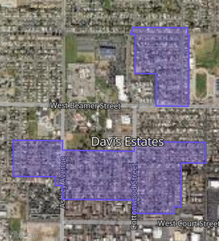
This property is located in Davis Estates, Woodland, CA 95695.
Seasonal Housing units 95695
9%of housing is for seasonal rent.
Daytime Population for 95695
-13%of people during work hours.
Boundary map of Davis Estates.
Crime Index for 95695
106
The crime index in 95695 is 106, which is 1.1 times higher than national average.
Market Trends
Historical market data near 285 Chestnut St over selected time period.
Nearby Properties on Chestnut St
- 285 Chestnut St, Woodland, CA 95695 (Davis Estates) is a 1,990 square foot, 4 bedroom, 2 bathroom, 0.15 acre property. It was built in 1967 and has an estimate of $513,365 with a price per ft² of $258.
- 257 Chestnut St, Woodland, CA 95695 (Davis Estates) is a 1,000 square foot, 3 bedroom, 1 bathroom, 0.14 acre property. It was built in 1967 and has an estimate of $405,701 with a price per ft² of $406.
- 253 Chestnut St, Woodland, CA 95695 (Davis Estates) is a 1,600 square foot, 3 bedroom, 2 bathroom, 0.14 acre property. It was built in 1966 and has an estimate of $425,827 with a price per ft² of $266.
- 289 Chestnut St, Woodland, CA 95695 (Davis Estates) is a 1,000 square foot, 3 bedroom, 1 bathroom, 0.15 acre property. It was built in 1967 and has an estimate of $440,750 with a price per ft² of $441.
- 281 Chestnut St, Woodland, CA 95695 (Davis Estates) is a 1,680 square foot, 3 bedroom, 2 bathroom, 0.14 acre property. It was built in 1967 and has an estimate of $487,036 with a price per ft² of $290.
- 293 Chestnut St, Woodland, CA 95695 (Davis Estates) is a 1,296 square foot, 3 bedroom, 2 bathroom, 0.16 acre property. It was built in 1967 and has an estimate of $425,736 with a price per ft² of $328.
- 277 Chestnut St, Woodland, CA 95695 (Davis Estates) is a 1,357 square foot, 3 bedroom, 1 bathroom, 0.14 acre property. It was built in 1967 and has an estimate of $448,842 with a price per ft² of $331.
- 249 Chestnut St, Woodland, CA 95695 (Davis Estates) is a 1,402 square foot, 4 bedroom, 2 bathroom, 0.16 acre property. It was built in 1966 and has an estimate of $442,848 with a price per ft² of $316.
- 261 Chestnut St, Woodland, CA 95695 (Davis Estates) is a 1,402 square foot, 4 bedroom, 2 bathroom, 0.14 acre property. It was built in 1966 and has an estimate of $404,260 with a price per ft² of $288.
- 265 Chestnut St, Woodland, CA 95695 (Davis Estates) is a 1,296 square foot, 3 bedroom, 2 bathroom, 0.14 acre property. It was built in 1967 and has an estimate of $438,684 with a price per ft² of $338.
- 269 Chestnut St, Woodland, CA 95695 (Davis Estates) is a 1,402 square foot, 4 bedroom, 2 bathroom, 0.14 acre property. It was built in 1967 and has an estimate of $428,488 with a price per ft² of $306.
- 273 Chestnut St, Woodland, CA 95695 (Davis Estates) is a 1,361 square foot, 3 bedroom, 2 bathroom, 0.14 acre property. It was built in 1967 and has an estimate of $458,203 with a price per ft² of $337.