2815 Brower Rd
Corbett, OR 97019
- 2Beds
- 1Bath
- 924ft²Living Area
- 38acLot Size
- -Pool
- -Car
- 1980Year Built
- -DOM
- 2Permits
Property Valuations
Latest estimates for 2815 Brower Rd based on TopHap automated valuation model (AVM).
TopHap Estimate
$420,826
$455/ft²
+$121K above Sold Price
Updated 6 months ago
Last Sold Price
$300,000
$325/ft²
27 years ago
2815 Brower Rd is valued at $420,826 by TopHap AVM 6 months ago.
2815 Brower Rd was last sold in 1997 for $300,000.
Permits
2815 Brower Rd has 2 permit records.
Current Ownership
Information about the current owner(s).
Taxes Billed
Taxes billed in 2023$5,457.01From latest Total Assessed Value1.49%Total Assessed Value$367,210=Land+
Assessed Value$0Additions
Assessed Value$0
In 2023, taxes billed for 2815 Brower Rd were $5,457.01, which is 1.49% from latest Total Assessed Value of $367,210.
Property History
2815 Brower Rd has undefined property events records (listings, deeds, permits, tax, foreclosure, loan).
Environment
Environmental factors around 2815 Brower Rd
Hazard Risks
Earthquake166Lead156Carb Mono139Air Pollution114Ozone109Nat'l Avg100Particulates90Tornado13Weather4Hail0Hurricane0Wind0
9 hazards (Carbon Monoxide, Earthquake Risk, Tornado Index, Air Pollution Index, Ozone Index, Weather Risk, Lead Index, Particulate Matter, National Average) are above the national average around 2815 Brower Rd.
Walkability Index
5 /20
Most Walkable
20-18
Very Walkable
17-15
Somewhat Walkable
14-10
Car Dependent
9-0
2815 Brower Rd has a walkability score of 5 out of 20, which means that it is in a car dependent area.
Temperature
Seasonal temperature sampled over multiple years
Winter
Average
Low
30°F
High
41°F
Summer
Average
Low
48°F
High
72°F
In the winter at 2815 Brower Rd, temperatures range from 29.7°F to 40.9°F with an average of 35.3°F. In the summer, the temperature ranges from 48.31°F to 72.02°F with and average of 60.17°F.
School Information
Public/private schools serving 2815 Brower Rd
Public Schools
Nearby public schools serving 2815 Brower Rd have ratings undefined.
Neighborhood
This property is located in Northeast Multnomah, Corbett, OR 97019.
Seasonal Housing units 97019
17%of housing is for seasonal rent.
Daytime Population for 97019
-19%of people during work hours.
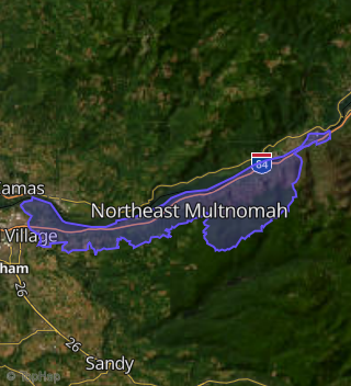
Boundary map of Northeast Multnomah.
Crime Index for 97019
67
The crime index in 97019 is 67, which is 0.7 times lower than national average.
Market Trends
Historical market data near 2815 Brower Rd over selected time period.
Nearby Properties on Brower Rd
- 2847 Ne Brower Rd, Corbett, OR 97019 (Northeast Multnomah) is a 1,664 square foot, 1 bedroom, 2 bathroom, 1.64 acre property. It was built in 1980 and has an estimate of $383,652 with a price per ft² of $231.
- 1550 Ne Brower Rd, Corbett, OR 97019 (East Sandy River Area) is a 1,200 square foot, 2 bedroom, 2 bathroom, 5.36 acre property. It was built in 1964 and has an estimate of $601,188 with a price per ft² of $501.
- 2101 Ne Brower Rd, Corbett, OR 97019 (Northeast Multnomah) is a 2,302 square foot, 3 bedroom, 3.25 bathroom, 9.91 acre property. It was built in 1925 and has an estimate of $907,776 with a price per ft² of $394.
- 1720 Ne Brower Rd, Corbett, OR 97019 (East Sandy River Area) is a 3,264 square foot, 5 bedroom, 3 bathroom, 5.32 acre property. It was built in 1979 and has an estimate of $634,860 with a price per ft² of $195.
- 1805 Ne Brower Rd, Corbett, OR 97019 (Northeast Multnomah) is a 2,015 square foot, 2 bedroom, 2 bathroom, 7.54 acre property. It was built in 1977 and has an estimate of $635,892 with a price per ft² of $316.
- 1835 Ne Brower Rd, Corbett, OR 97019 (Northeast Multnomah) is a 1,152 square foot, 2 bedroom, 2 bathroom, 6.15 acre property.
- 2323 Ne Brower Rd, Corbett, OR 97019 (Northeast Multnomah) is a 1,680 square foot, 2 bedroom, 2 bathroom, 6.13 acre property. It was built in 1986 and has an estimate of $241,008 with a price per ft² of $143.
- 1843 Ne Brower Rd, Corbett, OR 97019 (Northeast Multnomah) is a 1,980 square foot, 1 bedroom, 2 bathroom, 11.61 acre property.
- 1825 Ne Brower Rd, Corbett, OR 97019 (Northeast Multnomah) is a 1,032 square foot, 2 bedroom, 1 bathroom, 4.59 acre property. It was built in 1953 and has an estimate of $532,164 with a price per ft² of $516.
- 2815 Ne Brower Rd, Corbett, OR 97019 (Northeast Multnomah) is a 924 square foot, 2 bedroom, 1 bathroom, 37.68 acre property. It was built in 1980 and has an estimate of $509,256 with a price per ft² of $551.
- 2220 Ne Brower Rd, Corbett, OR 97019 (East Sandy River Area) is a 1,902 square foot, 4 bedroom, 1 bathroom, 7.87 acre property. It was built in 1912 and has an estimate of $219,432 with a price per ft² of $115.
- 2320 Ne Brower Rd, Corbett, OR 97019 (East Sandy River Area) is a 1,150 square foot, 3 bedroom, 1 bathroom, 5.14 acre property. It was built in 1981 and has an estimate of $263,784 with a price per ft² of $229.
- 1701 Ne Brower Rd, Corbett, OR 97019 (Northeast Multnomah) is a 980 square foot, 2 bedroom, 1 bathroom, 2 acre property.
- 2821 Ne Brower Rd, Corbett, OR 97019 (Northeast Multnomah) is a 2,809 square foot, 3 bedroom, 2 bathroom, 39.91 acre property. It was built in 1995 and has an estimate of $408,900 with a price per ft² of $146.
- 2817 Ne Brower Rd, Corbett, OR 97019 (Northeast Multnomah) is a 550 square foot, 2 bedroom, 1 bathroom, 39.35 acre property.
- 1500 Ne Brower Rd, Corbett, OR 97019 (East Sandy River Area) is a 3,405 square foot, 5 bedroom, 4.25 bathroom, 5.01 acre property. It was built in 1979 and has an estimate of $1,010,520 with a price per ft² of $297.
- 410 Ne Brower Rd, Corbett, OR 97019 (East Sandy River Area) is a 5,519 square foot, 6 bedroom, 4 bathroom, 46.06 acre property. It was built in 1996 and has an estimate of $1,134,168 with a price per ft² of $206.
- 1795 Ne Brower Rd, Corbett, OR 97019 (Northeast Multnomah) is a 1,456 square foot, 3 bedroom, 2 bathroom, 6.94 acre property.
- 601 Ne Brower Rd, Corbett, OR 97019 (East Sandy River Area) is a 1,182 square foot, 3 bedroom, 1 bathroom, 73.63 acre property. It was built in 1949 and has an estimate of $124,512 with a price per ft² of $105.
- 2445 Ne Brower Rd, Corbett, OR 97019 (Northeast Multnomah) is a 10.16 acre property.
- 1735 Ne Brower Rd, Corbett, OR 97019 (East Sandy River Area) is a 537 square foot, 1 bedroom, 80.1 acre property.
- 2847 Ne Brower Rd, Corbett, OR 97019 (Northeast Multnomah) is a 3.48 acre property.
- 410 Ne Brower Rd # E, Corbett, OR 97019 (East Sandy River Area) is a 80.01 acre property.
- 410 Ne Brower Rd, Corbett, OR 97019 (East Sandy River Area) is a 107.95 acre property.
- 1500 Ne Brower Rd # S, Corbett, OR 97019 (East Sandy River Area) is a 159.04 acre property. It has an estimate of $455,177.