242 Red Pheasant Dr
Vacaville, CA 95687
- 4Beds
- 4Baths
- 3,364ft²Living Area
- 6,843ft²Lot Size
- -Pool
- 2Car
- 2004Year Built
- -DOM
- 4Permits
Property Valuations
Latest estimates for 242 Red Pheasant Dr based on TopHap automated valuation model (AVM).
TopHap Estimate
$841,250
$250/ft²
+$218K above Sold Price
Updated 7 months ago
Last Sold Price
$622,915
$185/ft²
20 years ago
242 Red Pheasant Dr is valued at $841,250 by TopHap AVM 7 months ago.
242 Red Pheasant Dr was last sold in 2004 for $622,915.
Permits
242 Red Pheasant Dr has 4 permit records.
Current Ownership
Information about the current owner(s).
Taxes Billed
Taxes billed in 2023$8,800.48From latest Total Assessed Value1.13%Total Assessed Value$781,000=Land+
Assessed Value$132,000Additions
Assessed Value$649,000
In 2023, taxes billed for 242 Red Pheasant Dr were $8,800.48, which is 1.13% from latest Total Assessed Value of $781,000.
Property History
242 Red Pheasant Dr has undefined property events records (listings, deeds, permits, tax, foreclosure, loan).
Environment
Environmental factors around 242 Red Pheasant Dr
Hazard Risks
Earthquake377Nat'l Avg100Particulates89Ozone87Carb Mono83Air Pollution83Lead45Tornado3Wind2Hail1Weather1Hurricane0
11 hazards (Carbon Monoxide, Earthquake Risk, Hail Index, Tornado Index, Air Pollution Index, Ozone Index, Wind Index, Weather Risk, Lead Index, Particulate Matter, National Average) are above the national average around 242 Red Pheasant Dr.
Walkability Index
13 /20
Most Walkable
20-18
Very Walkable
17-15
Somewhat Walkable
14-10
Car Dependent
9-0
242 Red Pheasant Dr has a walkability score of 13 out of 20, which means that it is in a somewhat walkable area.
Temperature
Seasonal temperature sampled over multiple years
Winter
Average
Low
38°F
High
57°F
Summer
Average
Low
56°F
High
89°F
In the winter at 242 Red Pheasant Dr, temperatures range from 38.47°F to 56.9°F with an average of 47.69°F. In the summer, the temperature ranges from 55.71°F to 89.04°F with and average of 72.38°F.
School Information
Public/private schools serving 242 Red Pheasant Dr
Public Schools
Nearby public schools serving 242 Red Pheasant Dr have ratings undefined, undefined, and undefined.
Neighborhood
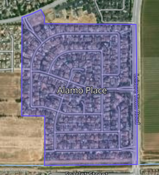
This property is located in Alamo Place, Vacaville, CA 95687.
Seasonal Housing units 95687
13%of housing is for seasonal rent.
Daytime Population for 95687
-11%of people during work hours.
Boundary map of Alamo Place.
Crime Index for 95687
71
The crime index in 95687 is 71, which is 0.7 times lower than national average.
Market Trends
Historical market data near 242 Red Pheasant Dr over selected time period.
Nearby Properties on Red Pheasant Dr
- 273 Red Pheasant Dr, Vacaville, CA 95687 (Alamo Place) is a 2,080 square foot, 3 bedroom, 3.25 bathroom, 0.15 acre property. It was built in 2004 and has an estimate of $689,453 with a price per ft² of $331.
- 231 Red Pheasant Dr, Vacaville, CA 95687 (Alamo Place) is a 2,288 square foot, 3 bedroom, 3.25 bathroom, 0.19 acre property. It was built in 2004 and has an estimate of $725,468 with a price per ft² of $317.
- 212 Red Pheasant Dr, Vacaville, CA 95687 (Alamo Place) is a 2,080 square foot, 3 bedroom, 2.5 bathroom, 0.19 acre property. It was built in 2004 and has an estimate of $672,434 with a price per ft² of $323.
- 224 Red Pheasant Dr, Vacaville, CA 95687 (Alamo Place) is a 3,296 square foot, 4 bedroom, 3 bathroom, 0.18 acre property. It was built in 2004 and has an estimate of $849,733 with a price per ft² of $258.
- 219 Red Pheasant Dr, Vacaville, CA 95687 (Alamo Place) is a 2,722 square foot, 4 bedroom, 3.25 bathroom, 0.22 acre property. It was built in 2004 and has an estimate of $771,794 with a price per ft² of $284.
- 278 Red Pheasant Dr, Vacaville, CA 95687 (Alamo Place) is a 3,623 square foot, 4 bedroom, 4.25 bathroom, 0.17 acre property. It was built in 2004 and has an estimate of $1,110,481 with a price per ft² of $307.
- 279 Red Pheasant Dr, Vacaville, CA 95687 (Alamo Place) is a 3,623 square foot, 4 bedroom, 4.25 bathroom, 0.15 acre property. It was built in 2004 and has an estimate of $838,802 with a price per ft² of $232.
- 213 Red Pheasant Dr, Vacaville, CA 95687 (Alamo Place) is a 2,080 square foot, 3 bedroom, 3.25 bathroom, 0.22 acre property. It was built in 2004 and has an estimate of $742,224 with a price per ft² of $357.
- 225 Red Pheasant Dr, Vacaville, CA 95687 (Alamo Place) is a 3,709 square foot, 5 bedroom, 4.25 bathroom, 0.21 acre property. It was built in 2004 and has an estimate of $833,213 with a price per ft² of $225.
- 236 Red Pheasant Dr, Vacaville, CA 95687 (Alamo Place) is a 3,709 square foot, 5 bedroom, 3.5 bathroom, 0.18 acre property. It was built in 2004 and has an estimate of $881,071 with a price per ft² of $238.
- 237 Red Pheasant Dr, Vacaville, CA 95687 (Alamo Place) is a 3,623 square foot, 4 bedroom, 4.25 bathroom, 0.18 acre property. It was built in 2004 and has an estimate of $861,486 with a price per ft² of $238.
- 200 Red Pheasant Dr, Vacaville, CA 95687 (Alamo Place) is a 3,296 square foot, 4 bedroom, 3 bathroom, 0.18 acre property. It was built in 2004 and has an estimate of $825,535 with a price per ft² of $250.
- 242 Red Pheasant Dr, Vacaville, CA 95687 (Alamo Place) is a 3,364 square foot, 4 bedroom, 3.5 bathroom, 0.16 acre property. It was built in 2004 and has an estimate of $794,666 with a price per ft² of $236.
- 243 Red Pheasant Dr, Vacaville, CA 95687 (Alamo Place) is a 3,296 square foot, 4 bedroom, 3 bathroom, 0.17 acre property. It was built in 2004 and has an estimate of $798,586 with a price per ft² of $242.
- 201 Red Pheasant Dr, Vacaville, CA 95687 (Alamo Place) is a 3,709 square foot, 5 bedroom, 4.25 bathroom, 0.2 acre property. It was built in 2004 and has an estimate of $860,172 with a price per ft² of $232.
- 248 Red Pheasant Dr, Vacaville, CA 95687 (Alamo Place) is a 2,080 square foot, 3 bedroom, 2.5 bathroom, 0.15 acre property. It was built in 2004 and has an estimate of $683,421 with a price per ft² of $329.
- 249 Red Pheasant Dr, Vacaville, CA 95687 (Alamo Place) is a 2,080 square foot, 3 bedroom, 3.25 bathroom, 0.16 acre property. It was built in 2004 and has an estimate of $683,733 with a price per ft² of $329.
- 206 Red Pheasant Dr, Vacaville, CA 95687 (Alamo Place) is a 3,709 square foot, 5 bedroom, 4.25 bathroom, 0.19 acre property. It was built in 2004 and has an estimate of $830,452 with a price per ft² of $224.
- 207 Red Pheasant Dr, Vacaville, CA 95687 (Alamo Place) is a 2,582 square foot, 4 bedroom, 2.5 bathroom, 0.2 acre property. It was built in 2004 and has an estimate of $771,284 with a price per ft² of $299.
- 254 Red Pheasant Dr, Vacaville, CA 95687 (Alamo Place) is a 2,975 square foot, 4 bedroom, 4.25 bathroom, 0.15 acre property. It was built in 2007 and has an estimate of $757,566 with a price per ft² of $255.
- 255 Red Pheasant Dr, Vacaville, CA 95687 (Alamo Place) is a 3,296 square foot, 4 bedroom, 3 bathroom, 0.15 acre property. It was built in 2004 and has an estimate of $832,956 with a price per ft² of $253.
- 260 Red Pheasant Dr, Vacaville, CA 95687 (Alamo Place) is a 2,080 square foot, 3 bedroom, 3.25 bathroom, 0.15 acre property. It was built in 2004 and has an estimate of $686,975 with a price per ft² of $330.
- 261 Red Pheasant Dr, Vacaville, CA 95687 (Alamo Place) is a 3,364 square foot, 4 bedroom, 4.25 bathroom, 0.15 acre property. It was built in 2004 and has an estimate of $792,887 with a price per ft² of $236.
- 267 Red Pheasant Dr, Vacaville, CA 95687 (Alamo Place) is a 3,296 square foot, 4 bedroom, 3 bathroom, 0.15 acre property. It was built in 2004 and has an estimate of $827,945 with a price per ft² of $251.
- 272 Red Pheasant Dr, Vacaville, CA 95687 (Alamo Place) is a 3,296 square foot, 4 bedroom, 3 bathroom, 0.15 acre property. It was built in 2004 and has an estimate of $829,613 with a price per ft² of $252.