227 Brookside Dr
Suisun City, CA 94585
- 3Beds
- 2Baths
- 1,555ft²Living Area
- 4,309ft²Lot Size
- -Pool
- 2Car
- 1999Year Built
- -DOM
- -Permit
Property Valuations
Latest estimates for 227 Brookside Dr based on TopHap automated valuation model (AVM).
TopHap Estimate
$529,750
$340/ft²
+$362K above Sold Price
Updated 7 months ago
Last Sold Price
$167,556
$108/ft²
26 years ago
227 Brookside Dr is valued at $529,750 by TopHap AVM 7 months ago.
227 Brookside Dr was last sold in 1999 for $167,556.
Current Ownership
Information about the current owner(s).
Taxes Billed
Taxes billed in 2023$3,811.54From latest Total Assessed Value1.51%Total Assessed Value$252,536=Land+
Assessed Value$45,198Additions
Assessed Value$207,338
In 2023, taxes billed for 227 Brookside Dr were $3,811.54, which is 1.51% from latest Total Assessed Value of $252,536.
Property History
227 Brookside Dr has undefined property events records (listings, deeds, permits, tax, foreclosure, loan).
Environment
Environmental factors around 227 Brookside Dr
Hazard Risks
Earthquake386Nat'l Avg100Particulates97Carb Mono87Ozone87Air Pollution83Lead37Hail2Hurricane0Tornado0Weather0Wind0
8 hazards (Carbon Monoxide, Earthquake Risk, Hail Index, Air Pollution Index, Ozone Index, Lead Index, Particulate Matter, National Average) are above the national average around 227 Brookside Dr.
Walkability Index
13 /20
Most Walkable
20-18
Very Walkable
17-15
Somewhat Walkable
14-10
Car Dependent
9-0
227 Brookside Dr has a walkability score of 13 out of 20, which means that it is in a somewhat walkable area.
Noise Level
45 dB
Quiet Suburban Residential 0-49
Suburban Residential 50-54
Urban Residential 55-59
Noisy Urban Residential 60-64
Very Noisy Urban Residential 65+
Noise at 227 Brookside Dr is around 45dBs, which is comparable to a Quiet Suburban Residential area.
Temperature
Seasonal temperature sampled over multiple years
Winter
Average
Low
39°F
High
57°F
Summer
Average
Low
55°F
High
85°F
In the winter at 227 Brookside Dr, temperatures range from 38.64°F to 56.84°F with an average of 47.74°F. In the summer, the temperature ranges from 55.33°F to 85.44°F with and average of 70.39°F.
School Information
Public/private schools serving 227 Brookside Dr
Public Schools
Nearby public schools serving 227 Brookside Dr have ratings undefined, undefined, undefined, and undefined.
Neighborhood
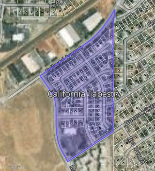
This property is located in California Tapestry, Suisun City, CA 94585.
Seasonal Housing units 94585
31%of housing is for seasonal rent.
Daytime Population for 94585
-29%of people during work hours.
Boundary map of California Tapestry.
Crime Index for 94585
70
The crime index in 94585 is 70, which is 0.7 times lower than national average.
Market Trends
Historical market data near 227 Brookside Dr over selected time period.
Nearby Properties on Brookside Dr
- 204 Brookside Dr, Suisun City, CA 94585 (California Tapestry) is a 1,533 square foot, 4 bedroom, 2 bathroom, 0.08 acre property. It was built in 1999 and has an estimate of $572,156 with a price per ft² of $373.
- 235 Brookside Dr, Suisun City, CA 94585 (California Tapestry) is a 1,957 square foot, 4 bedroom, 3.25 bathroom, 0.11 acre property. It was built in 1999 and has an estimate of $584,025 with a price per ft² of $298.
- 244 Brookside Dr, Suisun City, CA 94585 (California Tapestry) is a 1,957 square foot, 4 bedroom, 2 bathroom, 0.09 acre property. It was built in 1999 and has an estimate of $586,952 with a price per ft² of $300.
- 219 Brookside Dr, Suisun City, CA 94585 (California Tapestry) is a 1,727 square foot, 4 bedroom, 2 bathroom, 0.1 acre property. It was built in 1999 and has an estimate of $570,874 with a price per ft² of $331.
- 216 Brookside Dr, Suisun City, CA 94585 (California Tapestry) is a 1,766 square foot, 4 bedroom, 2 bathroom, 0.08 acre property. It was built in 1999 and has an estimate of $594,085 with a price per ft² of $336.
- 240 Brookside Dr, Suisun City, CA 94585 (California Tapestry) is a 1,727 square foot, 4 bedroom, 2 bathroom, 0.08 acre property. It was built in 1998 and has an estimate of $570,060 with a price per ft² of $330.
- 224 Brookside Dr, Suisun City, CA 94585 (California Tapestry) is a 1,957 square foot, 4 bedroom, 2 bathroom, 0.08 acre property. It was built in 1999 and has an estimate of $594,743 with a price per ft² of $304.
- 227 Brookside Dr, Suisun City, CA 94585 (California Tapestry) is a 1,555 square foot, 3 bedroom, 2 bathroom, 0.1 acre property. It was built in 1999 and has an estimate of $525,968 with a price per ft² of $338.
- 212 Brookside Dr, Suisun City, CA 94585 (California Tapestry) is a 1,957 square foot, 4 bedroom, 2 bathroom, 0.09 acre property. It was built in 1999 and has an estimate of $569,120 with a price per ft² of $291.
- 220 Brookside Dr, Suisun City, CA 94585 (California Tapestry) is a 1,533 square foot, 4 bedroom, 3.25 bathroom, 0.08 acre property. It was built in 1999 and has an estimate of $577,364 with a price per ft² of $377.
- 228 Brookside Dr, Suisun City, CA 94585 (California Tapestry) is a 1,358 square foot, 3 bedroom, 2 bathroom, 0.08 acre property. It was built in 1999 and has an estimate of $511,090 with a price per ft² of $376.
- 215 Brookside Dr, Suisun City, CA 94585 (California Tapestry) is a 1,766 square foot, 4 bedroom, 2 bathroom, 0.08 acre property. It was built in 1999 and has an estimate of $576,028 with a price per ft² of $326.
- 211 Brookside Dr, Suisun City, CA 94585 (California Tapestry) is a 1,957 square foot, 4 bedroom, 2 bathroom, 0.13 acre property. It was built in 1999 and has an estimate of $587,697 with a price per ft² of $300.
- 232 Brookside Dr, Suisun City, CA 94585 (California Tapestry) is a 1,727 square foot, 4 bedroom, 2 bathroom, 0.09 acre property. It was built in 1999 and has an estimate of $573,550 with a price per ft² of $332.
- 236 Brookside Dr, Suisun City, CA 94585 (California Tapestry) is a 1,533 square foot, 4 bedroom, 2 bathroom, 0.08 acre property. It was built in 1999 and has an estimate of $563,377 with a price per ft² of $367.
- 200 Brookside Dr, Suisun City, CA 94585 (California Tapestry) is a 1,727 square foot, 4 bedroom, 2 bathroom, 0.1 acre property. It was built in 1999 and has an estimate of $579,850 with a price per ft² of $336.
- 208 Brookside Dr, Suisun City, CA 94585 (California Tapestry) is a 1,727 square foot, 4 bedroom, 2 bathroom, 0.08 acre property. It was built in 1999 and has an estimate of $583,342 with a price per ft² of $338.
- 239 Brookside Dr, Suisun City, CA 94585 (California Tapestry) is a 1,555 square foot, 3 bedroom, 2 bathroom, 0.11 acre property. It was built in 1999 and has an estimate of $544,678 with a price per ft² of $350.
- 231 Brookside Dr, Suisun City, CA 94585 (California Tapestry) is a 1,766 square foot, 4 bedroom, 2 bathroom, 0.09 acre property. It was built in 1999 and has an estimate of $581,645 with a price per ft² of $329.