1830 Harms Dr
Pleasanton, CA 94566
- 3Beds
- 3Baths
- 1,609ft²Living Area
- 2,880ft²Lot Size
- -Pool
- -Car
- 1987Year Built
- -DOM
- -Permit
Property Valuations
Latest estimates for 1830 Harms Dr based on TopHap automated valuation model (AVM).
TopHap Estimate
$1,312,500
$815/ft²
-$173K below Sold Price
Updated 7 months ago
Last Sold Price
$1,485,000
$923/ft²
2 years ago
1830 Harms Dr is valued at $1,312,500 by TopHap AVM 7 months ago.
1830 Harms Dr was last sold in 2022 for $1,485,000.
Current Ownership
Information about the current owner(s).
Taxes Billed
Taxes billed in 2023$15,633.02From latest Total Assessed Value1.18%Total Assessed Value$1,325,000=Land+
Assessed Value$397,500Additions
Assessed Value$927,500
In 2023, taxes billed for 1830 Harms Dr were $15,633.02, which is 1.18% from latest Total Assessed Value of $1,325,000.
Property History
1830 Harms Dr has undefined property events records (listings, deeds, permits, tax, foreclosure, loan).
Environment
Environmental factors around 1830 Harms Dr
Hazard Risks
Earthquake598Particulates107Nat'l Avg100Ozone88Air Pollution88Carb Mono83Lead44Tornado9Wind8Weather1Hail0Hurricane0
10 hazards (Carbon Monoxide, Earthquake Risk, Tornado Index, Air Pollution Index, Ozone Index, Wind Index, Weather Risk, Lead Index, Particulate Matter, National Average) are above the national average around 1830 Harms Dr.
Walkability Index
17 /20
Most Walkable
20-18
Very Walkable
17-15
Somewhat Walkable
14-10
Car Dependent
9-0
1830 Harms Dr has a walkability score of 17 out of 20, which means that it is in a very walkable area.
Temperature
Seasonal temperature sampled over multiple years
Winter
Average
Low
40°F
High
57°F
Summer
Average
Low
54°F
High
84°F
In the winter at 1830 Harms Dr, temperatures range from 39.84°F to 57.31°F with an average of 48.58°F. In the summer, the temperature ranges from 53.61°F to 84.08°F with and average of 68.85°F.
School Information
Public/private schools serving 1830 Harms Dr
Public Schools
Nearby public schools serving 1830 Harms Dr have ratings undefined, undefined, and undefined.
Neighborhood
This property is located in Danbury Park, Pleasanton, CA 94566.
Seasonal Housing units 94566
19%of housing is for seasonal rent.
Daytime Population for 94566
+20%of people during work hours.
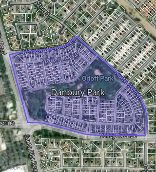
Boundary map of Danbury Park.
Crime Index for 94566
43
The crime index in 94566 is 43, which is 0.4 times lower than national average.
Market Trends
Historical market data near 1830 Harms Dr over selected time period.
Nearby Properties on Harms Dr
- 1806 Harms Dr, Pleasanton, CA 94566 (Danbury Park) is a 1,345 square foot, 2 bedroom, 2 bathroom, 0.11 acre property. It was built in 1987 and has an estimate of $1,093,146 with a price per ft² of $813.
- 1817 Harms Dr, Pleasanton, CA 94566 (Danbury Park) is a 1,369 square foot, 2 bedroom, 2 bathroom, 0.08 acre property. It was built in 1987 and has an estimate of $1,021,843 with a price per ft² of $746.
- 1830 Harms Dr, Pleasanton, CA 94566 (Danbury Park) is a 1,609 square foot, 3 bedroom, 3 bathroom, 0.07 acre property. It was built in 1987 and has an estimate of $1,210,324 with a price per ft² of $752.
- 1811 Harms Dr, Pleasanton, CA 94566 (Danbury Park) is a 1,731 square foot, 3 bedroom, 3.25 bathroom, 0.07 acre property. It was built in 1987 and has an estimate of $1,239,549 with a price per ft² of $716.
- 1818 Harms Dr, Pleasanton, CA 94566 (Danbury Park) is a 1,731 square foot, 3 bedroom, 3.25 bathroom, 0.07 acre property. It was built in 1987 and has an estimate of $1,161,426 with a price per ft² of $671.
- 1838 Harms Dr, Pleasanton, CA 94566 (Danbury Park) is a 1,839 square foot, 3 bedroom, 3.25 bathroom, 0.09 acre property. It was built in 1987 and has an estimate of $1,401,415 with a price per ft² of $762.
- 1847 Harms Dr, Pleasanton, CA 94566 (Danbury Park) is a 1,369 square foot, 2 bedroom, 2 bathroom, 0.08 acre property. It was built in 1987 and has an estimate of $1,015,397 with a price per ft² of $700.
- 1823 Harms Dr, Pleasanton, CA 94566 (Danbury Park) is a 1,731 square foot, 3 bedroom, 3.25 bathroom, 0.07 acre property. It was built in 1987 and has an estimate of $1,143,623 with a price per ft² of $661.
- 1846 Harms Dr, Pleasanton, CA 94566 (Danbury Park) is a 1,731 square foot, 3 bedroom, 3.25 bathroom, 0.08 acre property. It was built in 1987 and has an estimate of $1,246,994 with a price per ft² of $720.
- 1841 Harms Dr, Pleasanton, CA 94566 (Danbury Park) is a 1,609 square foot, 3 bedroom, 3 bathroom, 0.07 acre property. It was built in 1987 and has an estimate of $1,118,386 with a price per ft² of $695.
- 1842 Harms Dr, Pleasanton, CA 94566 (Danbury Park) is a 1,609 square foot, 3 bedroom, 3 bathroom, 0.08 acre property. It was built in 1987 and has an estimate of $1,228,265 with a price per ft² of $763.
- 1810 Harms Dr, Pleasanton, CA 94566 (Danbury Park) is a 1,730 square foot, 3 bedroom, 3 bathroom, 0.07 acre property. It was built in 1987 and has an estimate of $1,155,913 with a price per ft² of $668.
- 1829 Harms Dr, Pleasanton, CA 94566 (Danbury Park) is a 1,609 square foot, 2 bedroom, 3 bathroom, 0.06 acre property. It was built in 1988 and has an estimate of $1,052,014 with a price per ft² of $654.
- 1814 Harms Dr, Pleasanton, CA 94566 (Danbury Park) is a 1,731 square foot, 3 bedroom, 3.25 bathroom, 0.08 acre property. It was built in 1987 and has an estimate of $1,280,276 with a price per ft² of $740.
- 1805 Harms Dr, Pleasanton, CA 94566 (Danbury Park) is a 1,345 square foot, 2 bedroom, 2 bathroom, 0.11 acre property. It was built in 1987 and has an estimate of $1,091,760 with a price per ft² of $812.
- 1834 Harms Dr, Pleasanton, CA 94566 (Danbury Park) is a 1,345 square foot, 2 bedroom, 2 bathroom, 0.15 acre property. It was built in 1987 and has an estimate of $1,040,505 with a price per ft² of $774.
- 1822 Harms Dr, Pleasanton, CA 94566 (Danbury Park) is a 1,609 square foot, 3 bedroom, 3 bathroom, 0.07 acre property. It was built in 1987 and has an estimate of $1,131,168 with a price per ft² of $703.
- 1826 Harms Dr, Pleasanton, CA 94566 (Danbury Park) is a 1,345 square foot, 2 bedroom, 2 bathroom, 0.11 acre property. It was built in 1987 and has an estimate of $1,065,310 with a price per ft² of $792.
- 1835 Harms Dr, Pleasanton, CA 94566 (Danbury Park) is a 1,731 square foot, 3 bedroom, 3.25 bathroom, 0.07 acre property. It was built in 1987 and has an estimate of $1,138,724 with a price per ft² of $658.