12960 Burnt Cedar Ln
Pine Grove, CA 95665
- 3Beds
- 2Baths
- 1,853ft²Living Area
- 0.5acLot Size
- -Pool
- 2Car
- 1992Year Built
- -DOM
- -Permit
Property Valuations
Latest estimates for 12960 Burnt Cedar Ln based on TopHap automated valuation model (AVM).
TopHap Estimate
$476,300
$257/ft²
+$105K above Sold Price
Updated 7 months ago
Last Sold Price
$371,000
$200/ft²
3 years ago
12960 Burnt Cedar Ln is valued at $476,300 by TopHap AVM 7 months ago.
12960 Burnt Cedar Ln was last sold in 2021 for $371,000.
Current Ownership
Information about the current owner(s).
Taxes Billed
Taxes billed in 2023$4,450.46From latest Total Assessed Value1.05%Total Assessed Value$425,543=Land+
Assessed Value$79,590Additions
Assessed Value$345,953
In 2023, taxes billed for 12960 Burnt Cedar Ln were $4,450.46, which is 1.05% from latest Total Assessed Value of $425,543.
Property History
12960 Burnt Cedar Ln has undefined property events records (listings, deeds, permits, tax, foreclosure, loan).
Environment
Environmental factors around 12960 Burnt Cedar Ln
Hazard Risks
Nat'l Avg100Particulates99Earthquake91Air Pollution78Ozone77Carb Mono56Lead41Wind6Hail1Hurricane0Tornado0Weather0
9 hazards (Carbon Monoxide, Earthquake Risk, Hail Index, Air Pollution Index, Ozone Index, Wind Index, Lead Index, Particulate Matter, National Average) are above the national average around 12960 Burnt Cedar Ln.
Walkability Index
5 /20
Most Walkable
20-18
Very Walkable
17-15
Somewhat Walkable
14-10
Car Dependent
9-0
12960 Burnt Cedar Ln has a walkability score of 5 out of 20, which means that it is in a car dependent area.
Temperature
Seasonal temperature sampled over multiple years
Winter
Average
Low
38°F
High
56°F
Summer
Average
Low
60°F
High
89°F
In the winter at 12960 Burnt Cedar Ln, temperatures range from 37.81°F to 55.67°F with an average of 46.74°F. In the summer, the temperature ranges from 60.32°F to 89.3°F with and average of 74.81°F.
School Information
Public/private schools serving 12960 Burnt Cedar Ln
Public Schools
Nearby public schools serving 12960 Burnt Cedar Ln have ratings undefined, undefined, and undefined.
Neighborhood
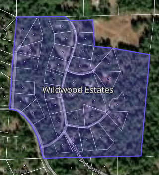
This property is located in Wildwood Estates, Pine Grove, CA 95665.
Seasonal Housing units 95665
71%of housing is for seasonal rent.
Daytime Population for 95665
-13%of people during work hours.
Boundary map of Wildwood Estates.
Crime Index for 95665
82
The crime index in 95665 is 82, which is 0.8 times lower than national average.
Market Trends
Historical market data near 12960 Burnt Cedar Ln over selected time period.
Nearby Properties on Burnt Cedar Ln
- 12825 Burnt Cedar Ln, Pine Grove, CA 95665 (Wildwood Estates) is a 2,436 square foot, 3 bedroom, 3 bathroom, 0.48 acre property. It was built in 1996 and has an estimate of $441,983 with a price per ft² of $181.
- 12871 Burnt Cedar Ln, Pine Grove, CA 95665 (Wildwood Estates) is a 2,460 square foot, 3 bedroom, 3 bathroom, 0.46 acre property. It was built in 1998 and has an estimate of $464,051 with a price per ft² of $189.
- 12891 Burnt Cedar Ln, Pine Grove, CA 95665 (Wildwood Estates) is a 2,554 square foot, 5 bedroom, 3 bathroom, 0.51 acre property. It was built in 1996 and has an estimate of $471,783 with a price per ft² of $185.
- 12791 Burnt Cedar Ln, Pine Grove, CA 95665 (Wildwood Estates) is a 1,832 square foot, 3 bedroom, 2 bathroom, 0.58 acre property. It was built in 2000 and has an estimate of $492,329 with a price per ft² of $269.
- 12824 Burnt Cedar Ln, Pine Grove, CA 95665 (Wildwood Estates) is a 0.44 acre property.
- 12850 Burnt Cedar Ln, Pine Grove, CA 95665 (Wildwood Estates) is a 1,948 square foot, 3 bedroom, 2 bathroom, 0.53 acre property. It was built in 2002 and has an estimate of $492,171 with a price per ft² of $253.
- 12790 Burnt Cedar Ln, Pine Grove, CA 95665 (Wildwood Estates) is a 1,882 square foot, 3 bedroom, 2 bathroom, 0.62 acre property. It was built in 2001 and has an estimate of $460,708 with a price per ft² of $245.
- 12851 Burnt Cedar Ln, Pine Grove, CA 95665 (Wildwood Estates) is a 1,830 square foot, 3 bedroom, 2 bathroom, 0.51 acre property. It was built in 2000 and has an estimate of $457,200 with a price per ft² of $250.
- 12925 Burnt Cedar Ln, Pine Grove, CA 95665 (Wildwood Estates) is a 1,800 square foot, 3 bedroom, 2 bathroom, 0.58 acre property. It was built in 1999 and has an estimate of $468,848 with a price per ft² of $260.
- 12940 Burnt Cedar Ln, Pine Grove, CA 95665 (Wildwood Estates) is a 1,881 square foot, 3 bedroom, 3.25 bathroom, 0.45 acre property. It was built in 1993 and has an estimate of $468,566 with a price per ft² of $249.
- 12780 Burnt Cedar Ln, Pine Grove, CA 95665 (Wildwood Estates) is a 1,709 square foot, 3 bedroom, 2 bathroom, 0.71 acre property. It was built in 1997 and has an estimate of $442,854 with a price per ft² of $259.
- 12870 Burnt Cedar Ln, Pine Grove, CA 95665 (Wildwood Estates) is a 2,189 square foot and 0.64 acre property. It was built in 1992 and has an estimate of $305,043 with a price per ft² of $139.
- 12920 Burnt Cedar Ln, Pine Grove, CA 95665 (Wildwood Estates) is a 0.55 acre property. It has an estimate of $542,800.
- 12960 Burnt Cedar Ln, Pine Grove, CA 95665 (Wildwood Estates) is a 1,853 square foot, 3 bedroom, 2 bathroom, 0.53 acre property. It was built in 1992 and has an estimate of $508,300 with a price per ft² of $274.
- 12941 Burnt Cedar Ln, Pine Grove, CA 95665 (Wildwood Estates) is a 0.61 acre property. It has an estimate of $434,600.
- 12961 Burnt Cedar Ln, Pine Grove, CA 95665 (Wildwood Estates) is a 1,486 square foot, 3 bedroom, 2 bathroom, 0.53 acre property. It was built in 1994 and has an estimate of $494,200 with a price per ft² of $333.
- 12770 Burnt Cedar Ln, Pine Grove, CA 95665 (Wildwood Estates) is a 0.48 acre property. It has an estimate of $331,900.
- 12970 Burnt Cedar Ln, Pine Grove, CA 95665 is a 4.32 acre property.