102 Millsford Ct
Tyrone, GA 30290
- -Bed
- -Bath
- 3,392ft²Living Area
- -Lot Size
- -Pool
- 2Car
- 2003Year Built
- -DOM
- -Permit
Property Valuations
Latest estimates for 102 Millsford Ct based on TopHap automated valuation model (AVM).
TopHap Estimate
$702,174
$207/ft²
+$316K above Sold Price
Updated 6 months ago
Last Sold Price
$386,000
$114/ft²
7 years ago
102 Millsford Ct is valued at $702,174 by TopHap AVM 6 months ago.
102 Millsford Ct was last sold in 2017 for $386,000.
Current Ownership
Information about the current owner(s).
Taxes Billed
Taxes billed in 2023$5,220.80From latest Total Assessed Value2.38%Total Assessed Value$219,760=Land+
Assessed Value$32,000Additions
Assessed Value$187,760
In 2023, taxes billed for 102 Millsford Ct were $5,220.8, which is 2.38% from latest Total Assessed Value of $219,760.
Property History
102 Millsford Ct has undefined property events records (listings, deeds, permits, tax, foreclosure, loan).
Environment
Environmental factors around 102 Millsford Ct
Hazard Risks
Particulates158Hurricane131Tornado131Weather124Nat'l Avg100Ozone100Air Pollution94Carb Mono83Wind51Earthquake46Lead42Hail36
12 hazards (Carbon Monoxide, Earthquake Risk, Hail Index, Tornado Index, Hurricane Index, Air Pollution Index, Ozone Index, Wind Index, Weather Risk, Lead Index, Particulate Matter, National Average) are above the national average around 102 Millsford Ct.
Walkability Index
8 /20
Most Walkable
20-18
Very Walkable
17-15
Somewhat Walkable
14-10
Car Dependent
9-0
102 Millsford Ct has a walkability score of 8 out of 20, which means that it is in a car dependent area.
Temperature
Seasonal temperature sampled over multiple years
Winter
Average
Low
34°F
High
56°F
Summer
Average
Low
67°F
High
89°F
In the winter at 102 Millsford Ct, temperatures range from 33.79°F to 55.67°F with an average of 44.73°F. In the summer, the temperature ranges from 66.68°F to 88.72°F with and average of 77.7°F.
School Information
Public/private schools serving 102 Millsford Ct
Public Schools
Nearby public schools serving 102 Millsford Ct have ratings undefined, undefined, and undefined.
Neighborhood
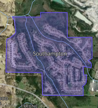
This property is located in Southampton, Tyrone, GA 30290.
Seasonal Housing units 30290
7%of housing is for seasonal rent.
Daytime Population for 30290
+7%of people during work hours.
Boundary map of Southampton.
Crime Index for 30290
77
The crime index in 30290 is 77, which is 0.8 times lower than national average.
Market Trends
Historical market data near 102 Millsford Ct over selected time period.
Nearby Properties on Millsford Ct
- 100 Millsford Ct, Tyrone, GA 30290 (Southampton) is a 3,424 square foot and 0.51 acre property. It was built in 2003 and has an estimate of $649,805 with a price per ft² of $190.
- 102 Millsford Ct, Tyrone, GA 30290 (Southampton) is a 3,392 square foot and 0.79 acre property. It was built in 2003 and has an estimate of $666,014 with a price per ft² of $196.
- 103 Millsford Ct, Tyrone, GA 30290 (Southampton) is a 3,617 square foot and 0.69 acre property. It was built in 2003 and has an estimate of $658,355 with a price per ft² of $182.
- 105 Millsford Ct, Tyrone, GA 30290 (Southampton) is a 3,574 square foot and 1.16 acre property. It was built in 2003 and has an estimate of $692,839 with a price per ft² of $194.
- 101 Millsford Ct, Tyrone, GA 30290 (Southampton) is a 3,624 square foot and 0.73 acre property. It was built in 2003 and has an estimate of $717,663 with a price per ft² of $198.