5939 Highway 26
Stockton, CA 95215
- 3Beds
- 2Baths
- 1,872ft²Living Area
- 0.4acLot Size
- -Pool
- 2Car
- 1954Year Built
- -DOM
- 1Permit
Property Valuations
Latest estimates for 5939 Highway 26 based on TopHap automated valuation model (AVM).
TopHap Estimate
$548,543
$293/ft²
+$4K above Sold Price
Updated 6 months ago
Last Sold Price
$545,000
$291/ft²
23 months ago
5939 Highway 26 is valued at $548,543 by TopHap AVM 6 months ago.
5939 Highway 26 was last sold in 2023 for $545,000.
Permits
5939 Highway 26 has 1 permit records.
Current Ownership
Information about the current owner(s).
Taxes Billed
Taxes billed in 2023$4,440.72From latest Total Assessed Value1.12%Total Assessed Value$395,352=Land+
Assessed Value$166,464Additions
Assessed Value$228,888
In 2023, taxes billed for 5939 Highway 26 were $4,440.72, which is 1.12% from latest Total Assessed Value of $395,352.
Property History
5939 Highway 26 has undefined property events records (listings, deeds, permits, tax, foreclosure, loan).
Environment
Environmental factors around 5939 Highway 26
Hazard Risks
Earthquake131Nat'l Avg100Particulates97Air Pollution84Carb Mono82Ozone82Lead41Tornado32Weather8Hail0Hurricane0Wind0
9 hazards (Carbon Monoxide, Earthquake Risk, Tornado Index, Air Pollution Index, Ozone Index, Weather Risk, Lead Index, Particulate Matter, National Average) are above the national average around 5939 Highway 26.
Walkability Index
5 /20
Most Walkable
20-18
Very Walkable
17-15
Somewhat Walkable
14-10
Car Dependent
9-0
5939 Highway 26 has a walkability score of 5 out of 20, which means that it is in a car dependent area.
Noise Level
52 dB
Quiet Suburban Residential 0-49
Suburban Residential 50-54
Urban Residential 55-59
Noisy Urban Residential 60-64
Very Noisy Urban Residential 65+
Noise at 5939 Highway 26 is around 52dBs, which is comparable to a Suburban Residential area.
Temperature
Seasonal temperature sampled over multiple years
Winter
Average
Low
38°F
High
56°F
Summer
Average
Low
57°F
High
91°F
In the winter at 5939 Highway 26, temperatures range from 38.1°F to 56.39°F with an average of 47.25°F. In the summer, the temperature ranges from 57.23°F to 90.93°F with and average of 74.08°F.
School Information
Public/private schools serving 5939 Highway 26
Public Schools
Nearby public schools serving 5939 Highway 26 have ratings undefined, and undefined.
Neighborhood
This property is located in Lindenwood Terrace, Stockton, CA 95215.
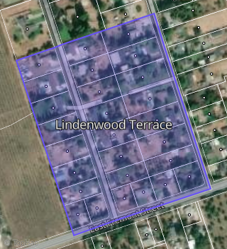
Boundary map of Lindenwood Terrace.
Crime Index for 95215
86
The crime index in 95215 is 86, which is 0.9 times lower than national average.
Market Trends
Historical market data near 5939 Highway 26 over selected time period.
Nearby Properties on Highway 26
- 10187 E Highway 26, Stockton, CA 95215 is a 1,416 square foot, 2 bedroom, 1 bathroom, 0.78 acre property. It was built in 1959 and has an estimate of $420,677 with a price per ft² of $297.
- 10227 E Highway 26, Stockton, CA 95215 is a 1,904 square foot, 3 bedroom, 1 bathroom, 1.27 acre property. It was built in 1950 and has an estimate of $544,985 with a price per ft² of $286.
- 10453 E Highway 26, Stockton, CA 95215 is a 1,898 square foot, 4 bedroom, 2 bathroom, 1.25 acre property. It was built in 1971 and has an estimate of $616,257 with a price per ft² of $325.
- 11111 E Highway 26, Stockton, CA 95215 is a 3.14 acre property.
- 12123 E Highway 26, Stockton, CA 95215 is a 21.12 acre property.
- 12573 E Highway 26, Stockton, CA 95215 is a 1,199 square foot, 2 bedroom, 1 bathroom, 1 acre property. It was built in 1938 and has an estimate of $522,792 with a price per ft² of $436.
- 12707 E Highway 26, Stockton, CA 95215 is a 4.64 acre property.
- 11818 E Highway 26, Stockton, CA 95215 is a 1,220 square foot, 2 bedroom, 1 bathroom, 10.4 acre property. It was built in 1954 and has an estimate of $856,477 with a price per ft² of $702.
- 5939 E Highway 26, Stockton, CA 95215 is a 0.35 acre property.
- 5936 E Highway 26, Stockton, CA 95215 is a 1.49 acre property.
- 7309 E Highway 26, Stockton, CA 95215 is a 13.91 acre property.
- 8227 E Highway 26, Stockton, CA 95215 is a 3.91 acre property.
- 7239 E Highway 26, Stockton, CA 95215 is a 101.81 acre property.
- 5750 E Highway 26, Stockton, CA 95215 is a 28.82 acre property.
- 10500 E Highway 26, Stockton, CA 95215 is a 3.77 acre property.
- 7718 E Highway 26, Stockton, CA 95215 is a 4,064 square foot, 5 bedroom, 3 bathroom, 2 acre property. It was built in 1993 and has an estimate of $1,292,317 with a price per ft² of $318.
- 11090 E Highway 26, Stockton, CA 95215 is a 6.32 acre property.
- 11176 E Highway 26, Stockton, CA 95215 is a 1,502 square foot, 2 bedroom, 1 bathroom, 2 acre property. It was built in 1949 and has an estimate of $516,816 with a price per ft² of $344.
- View more properties on Highway 26