5620 Michael P Anderson Ln
El Paso, TX 79934
- 3Beds
- 2Baths
- 1,331ft²Living Area
- 4,879ft²Lot Size
- -Pool
- 1Car
- 2004Year Built
- -DOM
- 1Permit
Property Valuations
Latest estimates for 5620 Michael P Anderson Ln based on TopHap automated valuation model (AVM).
TopHap Estimate
$204,513
$153/ft²
Updated 6 months ago
5620 Michael P Anderson Ln is valued at $204,513 by TopHap AVM 6 months ago.
Permits
5620 Michael P Anderson Ln has 1 permit records.
Current Ownership
Information about the current owner(s).
Taxes Billed
Taxes billed in 2023$2,376.14From latest Total Assessed Value1.3%Total Assessed Value$183,309=Land+
Assessed Value$25,830Additions
Assessed Value$157,479
In 2023, taxes billed for 5620 Michael P Anderson Ln were $2,376.14, which is 1.30% from latest Total Assessed Value of $183,309.
Property History
5620 Michael P Anderson Ln has undefined property events records (listings, deeds, permits, tax, foreclosure, loan).
Environment
Environmental factors around 5620 Michael P Anderson Ln
Hazard Risks
Lead119Particulates112Air Pollution102Nat'l Avg100Ozone98Carb Mono81Earthquake73Tornado19Weather12Hurricane10Hail4Wind4
12 hazards (Carbon Monoxide, Earthquake Risk, Hail Index, Tornado Index, Hurricane Index, Air Pollution Index, Ozone Index, Wind Index, Weather Risk, Lead Index, Particulate Matter, National Average) are above the national average around 5620 Michael P Anderson Ln.
Walkability Index
11 /20
Most Walkable
20-18
Very Walkable
17-15
Somewhat Walkable
14-10
Car Dependent
9-0
5620 Michael P Anderson Ln has a walkability score of 11 out of 20, which means that it is in a somewhat walkable area.
Temperature
Seasonal temperature sampled over multiple years
Winter
Average
Low
32°F
High
59°F
Summer
Average
Low
66°F
High
94°F
In the winter at 5620 Michael P Anderson Ln, temperatures range from 31.67°F to 59.25°F with an average of 45.46°F. In the summer, the temperature ranges from 66.18°F to 93.86°F with and average of 80.02°F.
School Information
Public/private schools serving 5620 Michael P Anderson Ln
Public Schools
Nearby public schools serving 5620 Michael P Anderson Ln have ratings undefined, undefined, undefined, undefined, undefined, and undefined.
Neighborhood
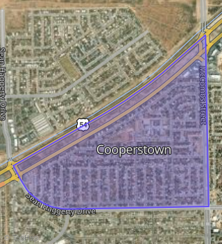
This property is located in Cooperstown, El Paso, TX 79934.
Seasonal Housing units 79934
34%of housing is for seasonal rent.
Daytime Population for 79934
-37%of people during work hours.
Boundary map of Cooperstown.
Crime Index for 79934
84
The crime index in 79934 is 84, which is 0.8 times lower than national average.
Market Trends
Historical market data near 5620 Michael P Anderson Ln over selected time period.
Nearby Properties on Michael P Anderson Ln
- 5661 Michael P Anderson Ln, El Paso, TX 79934 (Cooperstown) is a 1,530 square foot, 3 bedroom, 2 bathroom, 0.11 acre property. It was built in 2004 and has an estimate of $201,264 with a price per ft² of $132.
- 5737 Michael P Anderson Ln, El Paso, TX 79934 (Cooperstown) is a 1,744 square foot, 3 bedroom, 2 bathroom, 0.13 acre property. It was built in 2004 and has an estimate of $209,636 with a price per ft² of $120.
- 5740 Michael P Anderson Ln, El Paso, TX 79934 (Cooperstown) is a 2,349 square foot, 4 bedroom, 2 bathroom, 0.13 acre property. It was built in 2004 and has an estimate of $262,896 with a price per ft² of $112.
- 5720 Michael P Anderson Ln, El Paso, TX 79934 (Cooperstown) is a 2,021 square foot, 3 bedroom, 2 bathroom, 0.11 acre property. It was built in 2004 and has an estimate of $228,193 with a price per ft² of $113.
- 5641 Michael P Anderson Ln, El Paso, TX 79934 (Cooperstown) is a 1,180 square foot, 3 bedroom, 2 bathroom, 0.11 acre property. It was built in 2004 and has an estimate of $189,066 with a price per ft² of $160.
- View more properties on Michael P-Anderson-Ln